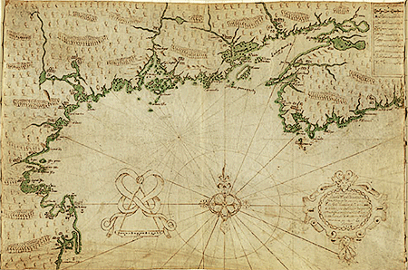
Closeup of Map
The Library of Congress has a beautiful copy of this map that you can download, or view closeup.
Between 1604 and 1607 the French settled in the area of St Croix Island and spread out over the area of Acadia. Unfortunately this site does not mention the series of expulsions of the Acadians to the French colony of Louisiana during the eighteenth century. The descendants of these settlers are called “Cajuns” today. Jambalaya anyone?
This site describes the six maps that Champlain made of New France (current day Canada), as well as the seventeen detailed maps he created of specific locations in New France
The area of the northeastern United States and Canada shown below is that covered by Champlain’s map.
View Champlain’s Map in a larger map